


- Daily Note
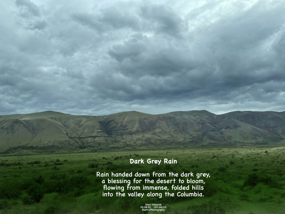
Every day, a photograph, a poem. On our journey to and from our granddaughter’s wedding, we chose the back roads though they added thirty minutes to the drive. It’s just so beautiful with little traffic that it’s worth the extra time. On Highway 243 [via Highway 241 and 24], this view along the Columbia River shows the east-west folded hills on which I-82 travels— up and down these high hills with semi-trucks and cars in heavy traffic. That’s what we avoided.
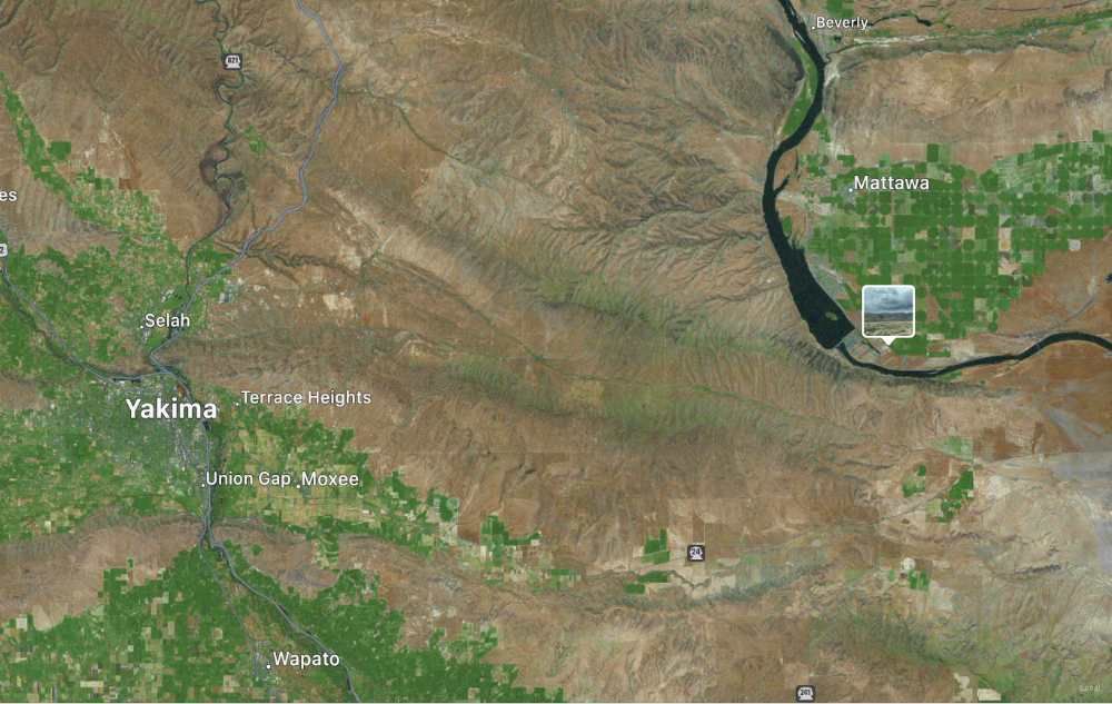
In the map below, I-82 isn’t listed, but it follows north-south with the Yakima River through Yakima down to Oregon. That’s what we avoided. The geology is endlessly mesmerizing. The photo insert is the photo above, and you can see the ridge lines of the east-west ridges of the “fold and thrust” Yakima Fold Belt.
I snapped the photo to show the hillside and the rain clouds, which seem to be a benevolent hand dropping much needed rain on this desert / semi-arid area in Eastern Washington.
And so, a poem.
Poetry
Dark Grey Rain
Rain handed down from the dark grey,
Sheri Edwards
a blessing for the desert to bloom,
flowing from immense, folded hills
into the valley along the Columbia.
05.08.23 129.365.23
Poetry/Photography [See-Frame-Focus]
Yakima Fold Belt along the Columbia River near Hanford Reach
